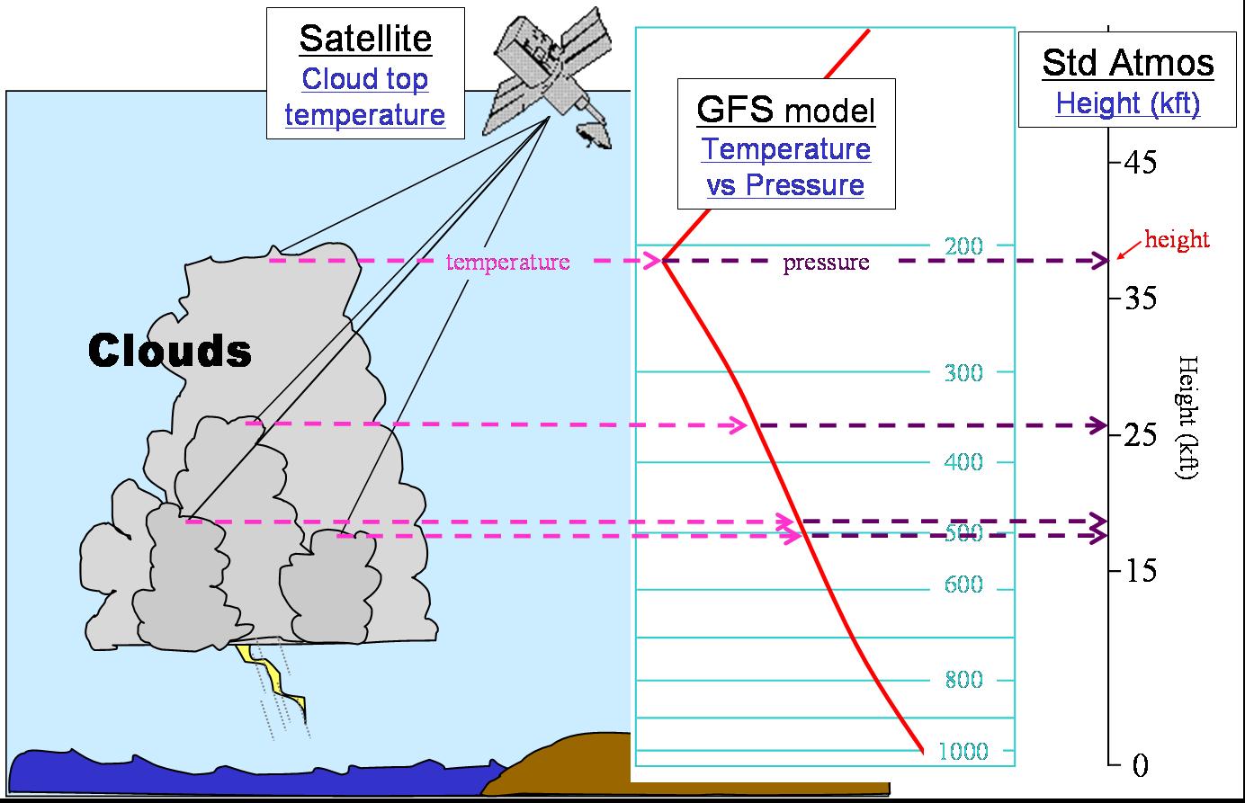
The Cloud Top Height (CTOP) product combines geostationary satellite Infrared data and numerical weather prediction output to create a detailed diagnosis of the estimated heights of convective cloud tops over the open ocean. Provided that clouds are of sufficient optical thickness such that transmission from the lower atmosphere may be safely neglected (such as occurs within deep convection), the emitting temperature of the cloud across the ~11.0 micron window channel is assumed to be representative of the ambient environment. Soundings generated by the National Center for Environmental Prediction (NCEP) Global Forecasting System (GFS) numerical model are employed to convert the satellite brightness temperatures to flight-level altitudes (expressed in Kilo-feet). Specifically, the CTOP makes a conversion from satellite brightness temperature to the equivalent GFS pressure surface. This pressure level is then used to interpolate to a standard atmosphere height. Similarly, aircraft altimeters also convert a pressure measurement to an equivalent altitude using the standard atmosphere.
The product performs for both day- and night-time hours and gives valid results for clouds with tops at and above 15,000 feet.
Dr. Steve Miller, Naval Research Laboratory in Monterey, CA (NRL-MRY), developed the CTOP algorithm. The following reference applies: